Parcel data
Parcel data tables can be joined on their parcel identifier (see Joining parcel data)
Fair market value (FMV) estimates
Parcel-level estimates of property value from models.
- Example:
25011_parcel_predictions.pqtis a table of parcel-level predictor data for Franklin county, Massachusetts.- File location:
parcels/<state>/<county>/<county>_parcel_predictions_pqt.zip- Columns:
fmv_<model_id>_<year>model_ididentifies the model, andyearis the year for which the prediction was made.
- Unit:
Natural logarithm of U.S. dollars (real, deflated to Jan 2022)
- Format:
Compressed Parquet table
Predictor data
Parcel-level table of all predictors used by models.
- Example:
25011_parcel_predictors.pqtis a table of parcel-level predictor data for Franklin county, Massachusetts- File location:
parcels/<state>/<county>/<county>_parcel_predictions_pqt.zip- Columns:
For an interpretation of column names and units, see predictors.
- Format:
Compressed Parquet table
Area of applicability (AOA) data
Parcel-level indicators of the Area of Applicability (AOA) for the FMV estimates, standardized.
The AOA is a measure of dissimilarity: how “different” is each predicted parcel sale from the sales in the sample that the predicting model was trained on?
It can help identify parts of the landscape for which predictions are extrapolated far beyond the characteristics of the original sample. If such extrapolation occurs, prediction errors and biases can (and often will) be larger than we were able to estimate from the training sample.
Such extrapolation can happen for a number of reasons: some parcels have a particularly unique set of characteristics, others are of a certain type that rarely sells (such as large government-owned lands), others might be located in parts of the landscape with few sales data observations (e.g. non-disclosure states).
Computationally, it is the Euclidean distance in weighted predictor space, where predictors are weighted by their importance in the model (see Meyer & Pebesma 2021).
- Example:
25011_parcel_aoa.pqtis a table of parcel-level AOA measures for Franklin county, Massachusetts- File location:
parcels/<state>/<county>/<county>_parcel_aoa_pqt.zip- Columns:
aoa_<model_id>_<year>_<cross-validation_type>model_ididentifies the model.yearis the year for which the prediction was made.cross-validation_typeidentifies the type of cross-validation used to find the AOA threshold.
- Unit:
Unitless distance, rescaled
Values ≤0 are within the threshold of the AOA, values ≥0 are outside.
\[ln(\frac{dissimilarity\;index}{AOA\;threshold})\]- Format:
Compressed Parquet table
Joining parcel data
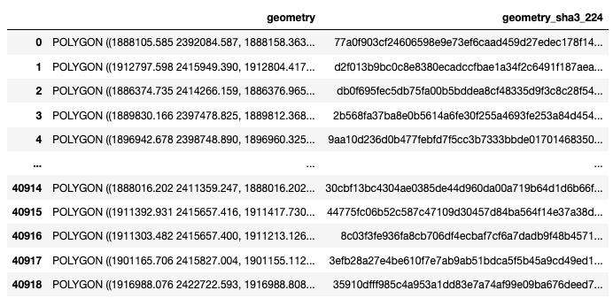
All parcel data products use the same parcel identifier: geometry_sha3_224
These are hashed geo-referenced parcel geometries (polygons). If you have access to the same parcel boundary data, you can link up our data to yours.
We picked geometry_sha3_224, as it is:
easy to generate: you need a parcel boundary vector file, Python, and geopandas.
unambiguous: if our parcel identifiers match, you know you have the right polygon.
secure: access to the published parcel identifiers does not permit the re-creation of parcel geometries. This was a precondition for publishing data derived from licensed parcel boundaries.
Linkage algorithm
With this Python code snippet, you can generate geometry_sha3_224 from your parcel boundary data (geo-referenced polygons).
The code requires the Python package geopandas, which provides functionality for vector data processing in Python (installation instructions).
Replace PATH with the filepath to your parcel data file.
Any vector file format supported by fiona should work (e.g. .shp, .gpkg, .gdb).
If the vector data is provided in a different projection than EPSG 5070 (CONUS Albers), it will be reprojected. That step can take a few minutes or more.:
import hashlib
import geopandas as gpd

# Path to your parcel data file
PATH = '/folder_to_your_parcel_data/25011_parcels.gpkg'

print('Reading...')
parcels = gpd.read_file(PATH)

if not parcels.crs == 'epsg:5070':
    print('Reprojecting...')
    parcels = parcels.to_crs('epsg:5070')

def to_sha3_224(x):
    m = hashlib.sha3_224()
    m.update(bytes(str(x), encoding='utf-8'))
    return m.hexdigest()

parcels['geometry_sha3_224'] = parcels['geometry'].apply(to_sha3_224)

parcels[['geometry', 'geometry_sha3_224']]
The last line will return a pandas DataFrame that should look similar to this one (Franklin county, Massachusetts, MassGIS).
Save it with .to_csv, .to_excel, .to_parquet, etc.